


Voting District 14, Seminole County, Oklahoma
About
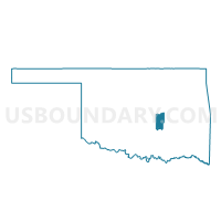
Outline

Summary
| Unique Area Identifier | 655161 |
| Name | Voting District 14 |
| County | Seminole County |
| State | Oklahoma |
| Area (square miles) | 63.89 |
| Land Area (square miles) | 60.78 |
| Water Area (square miles) | 3.11 |
| % of Land Area | 95.13 |
| % of Water Area | 4.87 |
| Latitude of the Internal Point | 34.97839110 |
| Longtitude of the Internal Point | -96.73551880 |
Maps


Graphs
Select a template below for downloading or customizing gragh for Voting District 14, Seminole County, Oklahoma


Neighbors
Neighoring Voting District (by Name) Neighboring Voting District on the Map
- Voting District 11, Seminole County, OK
- Voting District 12, Seminole County, OK
- Voting District 24, Seminole County, OK
- Voting District 40, Pottawatomie County, OK
- Voting District 41, Pottawatomie County, OK
- Voting District 59, Pontotoc County, OK
- Voting District 60, Pontotoc County, OK
- Voting District 66, Pontotoc County, OK
Top 10 Neighboring County Subdivision (by Population) Neighboring County Subdivision on the Map
- Northeast Pontotoc CCD, Pontotoc County, OK (5,135)
- Northwest Pontotoc CCD, Pontotoc County, OK (4,676)
- Wanette-Asher CCD, Pottawatomie County, OK (2,900)
- Konawa CCD, Seminole County, OK (2,852)
- Seminole South CCD, Seminole County, OK (2,179)
- Maud CCD, Pottawatomie County, OK (1,952)
Top 10 Neighboring Place (by Population) Neighboring Place on the Map
Top 10 Neighboring Unified School District (by Population) Neighboring Unified School District on the Map
- Byng Public Schools, OK (8,550)
- Konawa Public Schools, OK (3,537)
- Latta Public Schools, OK (3,329)
- Vanoss Public Schools, OK (2,698)
- Maud Public Schools, OK (1,919)
- Bowlegs Public Schools, OK (1,493)
Top 10 Neighboring State Legislative District Lower Chamber (by Population) Neighboring State Legislative District Lower Chamber on the Map
- State House District 27, OK (36,934)
- State House District 25, OK (36,224)
- State House District 28, OK (35,663)
Top 10 Neighboring State Legislative District Upper Chamber (by Population) Neighboring State Legislative District Upper Chamber on the Map
- State Senate District 28, OK (76,209)
- State Senate District 17, OK (74,685)
- State Senate District 13, OK (73,191)
Top 10 Neighboring 111th Congressional District (by Population) Neighboring 111th Congressional District on the Map
Top 10 Neighboring Census Tract (by Population) Neighboring Census Tract on the Map
- Census Tract 886, Pontotoc County, OK (5,135)
- Census Tract 895.98, Pontotoc County, OK (4,676)
- Census Tract 5013, Pottawatomie County, OK (2,900)
- Census Tract 5838, Seminole County, OK (2,852)
- Census Tract 5837, Seminole County, OK (2,179)
- Census Tract 5012.01, Pottawatomie County, OK (1,981)